


On April 23, 2026, at Singapore Maritime Week 2026 (SMW 2026), ContiOcean Environment Tech Group Co., Ltd. (“ContiOcean Group” or “ContiOcean”) and Wuxi Ninecosmos Science And Technology Co., Ltd. (“Ninecosmos”) officially signed a cooperation agreement on “Intelligent Meteorological Navigation.” The signing marks a further step in the two parties’ collaboration, moving from strategic synergy toward joint product development and scenario-based implementation.

From Strategy to Substance: Successful Launch of the First Pilot Project
ContiOcean Group and Ninecosmos have continued to collaborate on the integration of meteorological navigation capabilities and route optimization applications. With ContiOcean’s Intelligent Vessel System (COIVS) as the core platform, and leveraging Ninecosmos’ technical expertise in meteorological navigation and intelligent shipping decision-making, the two parties are jointly advancing intelligent meteorological navigation from technical validation to product integration.
In February this year, ContiOcean Group successfully carried out the first pilot project of the ContiOcean Intelligent Vessel System (COIVS), integrating Ninecosmos’ meteorological navigation function, JoPilot. The smooth progress and successful operation of the project provided strong validation for the application of the two parties’ collaborative achievements in real business scenarios, while also laying a solid foundation for the continuous optimization and further expansion of intelligent meteorological navigation and related products.
In-Depth Bilateral Cooperation: Empowering Smart Shipping
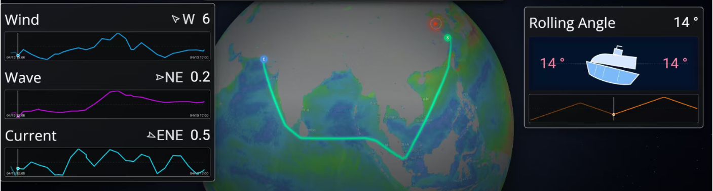
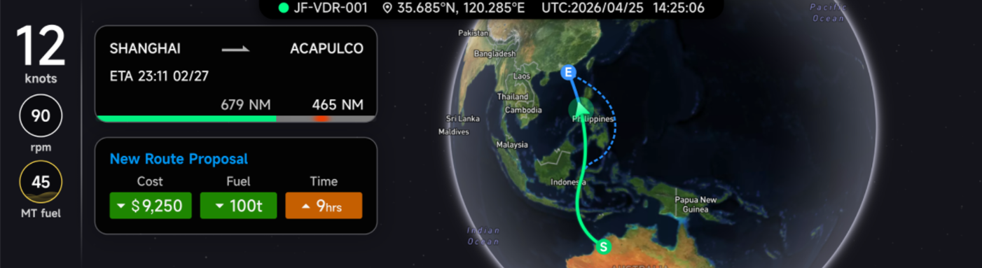
The “Intelligent meteorological navigation” collaboration will be further deeply integrated into the COIVS Intelligent Vessel System. As an intelligent meteorological navigation module embedded in the COIVS platform, JoPilot combines global high-precision weather forecast data with real-time onboard operating data to provide more comprehensive and accurate navigational decision support for vessel operations:
-
Panoramic weather visualization: Intuitively displays various meteorological and oceanographic information, including wind fields, waves, currents, and tropical cyclones, while supporting future weather evolution queries and monitoring of key sea areas.
-
Dynamic risk alerts: Integrates vessel performance models and real-time data to accurately identify risks along future routes, providing reliable references for avoiding severe weather.
-
Multi-objective intelligent optimization: Achieves a better balance between safety and efficiency in route planning, with the system delivering an average energy saving of approximately 4.5% and a route time reduction of 2.5%.
-
End-to-end refined management: Provides full-process support before, during, and after voyages, including core functions such as automatic noon report generation and ship-shore collaborative monitoring.
This signing is not only another important milestone in the cooperation between the two parties, but also a significant step toward accelerating the application of intelligent meteorological navigation capabilities on actual vessels and in real voyages. Looking ahead, ContiOcean Group and Ninecosmos will take this cooperation as a new starting point to continue advancing product optimization, onboard validation, and scenario expansion for intelligent meteorological navigation. Together, they will further enhance the system’s comprehensive capabilities in complex sea condition identification, dynamic route optimization, energy efficiency management, and ship-shore collaboration, jointly promoting the development of smart shipping toward greater safety, efficiency, and sustainability.